A sunny and warmer Sunday
SAGINAW, Mich. (WNEM) -
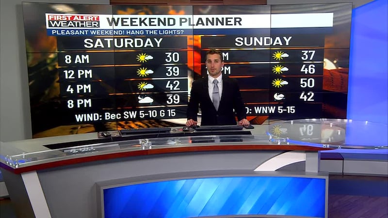
The overall weather outlook for the day played out well across much of mid‑Michigan, with cooler temperatures, plenty of sunshine, and calmer winds. Sunday looks to continue the trend, and many expect it to be even nicer than Saturday. Conditions like this could linger into the start of the week before a change arrives midweek. I have more details below.
For a complete look at your forecast, be sure to check out your TV5 First Alert 7-Day Forecast!
Tonight:
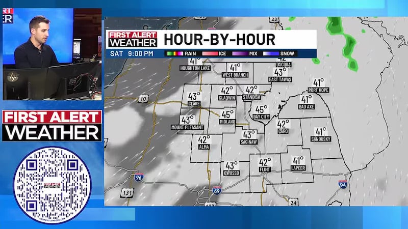
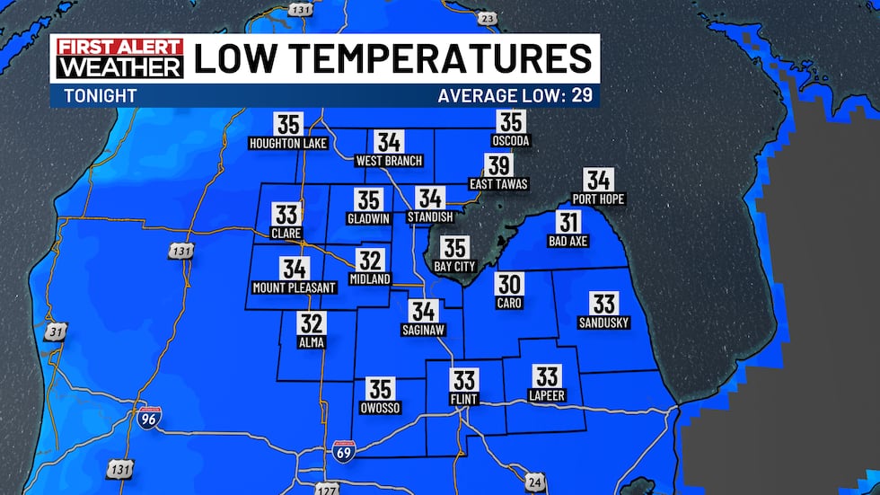
While a few rain/snow showers developed around sunset, most of that precipitation was light and quick-moving, leaving us with a mostly dry night. Skies will be a mix of clouds and sun, and temperatures will remain relatively stable, dropping into the mid-to-lower 30s across much of mid-Michigan.
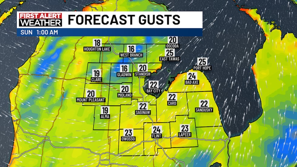
One change tonight will be increasing winds. By midnight, winds are expected to be mostly west to southwest at 10–20 MPH with gusts up to 25 MPH. Winds will continue to increase through the night into Sunday morning.
Sunday:
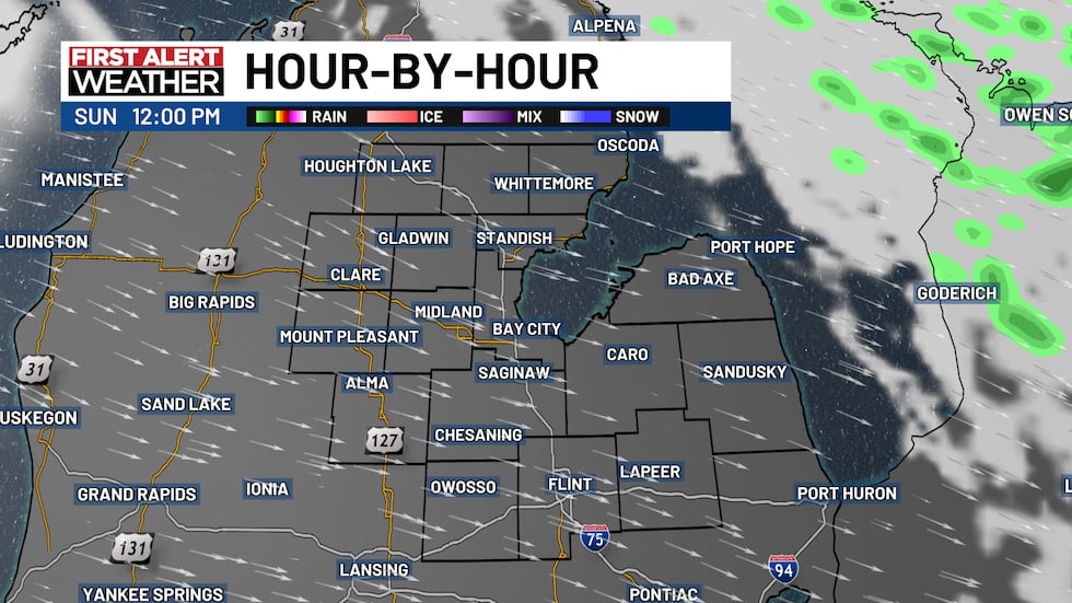
A few clouds may linger into Sunday morning, but skies should stay dry. Around midday clouds will begin to clear and the sun will return. The remainder of the afternoon will be mostly sunny, with clear skies persisting into Sunday night and Monday.
Winds will remain breezy following tonight’s increase, but the direction will shift from southwest to northwest. Expect northwest winds around 10–20 MPH with gusts up to 25 MPH.
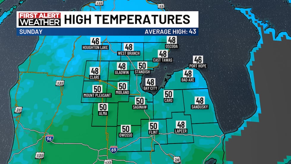
High temperatures will be a bit warmer than Saturday, rising into the upper 40s to lower 50s across much of the region.
Next Week:
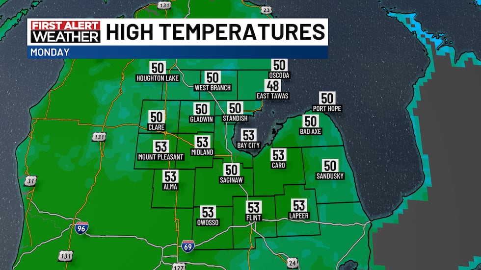
Monday will be a carryover of Sunday with mostly sunny skies and highs in the 50s. Clouds will increase Monday afternoon ahead of a stronger low-pressure system tracking across the country.
Monday night into Tuesday, that low looks to influence mid-Michigan with a widespread rain chance. Because warmer air will be in place early in the week, most precipitation on Tuesday is expected to fall as rain.
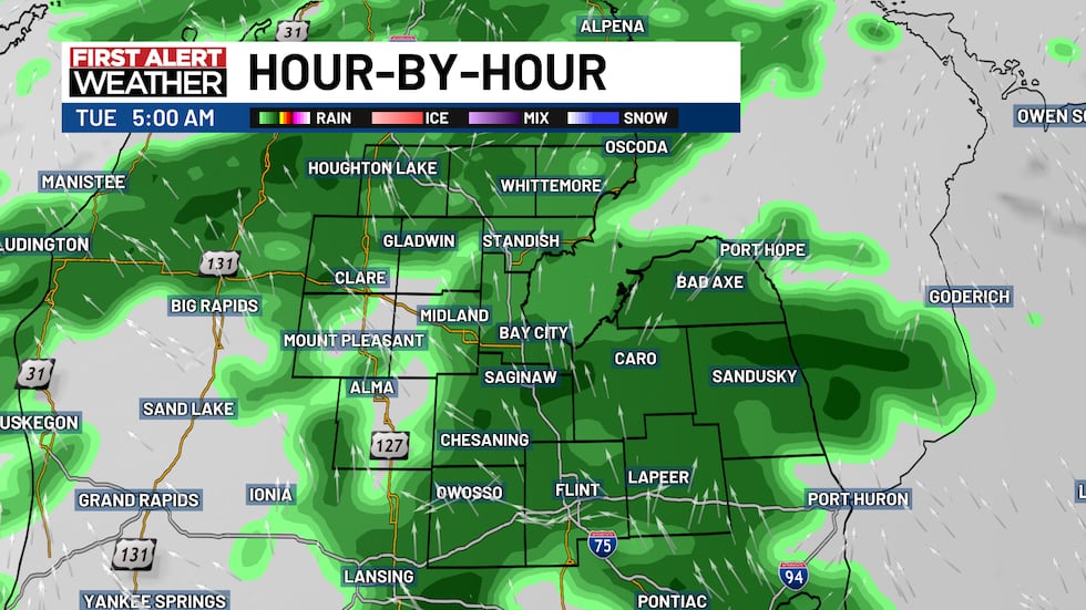
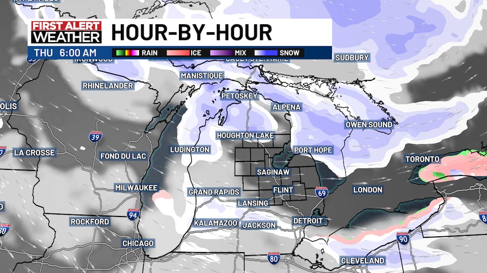
Another round of showers is possible Wednesday. Timing and coverage remain uncertain, but models suggest showers will likely begin as rain Wednesday before transitioning to a mix or snow late Wednesday into Thursday as colder air arrives.
Thanksgiving (Thursday):
Colder air is expected to arrive in time for Thanksgiving, with the potential for lake-effect snow showers. Coverage and amounts from lake-effect snow remain uncertain, if you’re traveling for the holiday, keep an eye on updates.
Temperatures will start to fall to end the week with 30s back in the forecast for the foreseeable future as colder air moved into the region.
Copyright 2025 WNEM. All rights reserved.