Heat builds Wednesday & Thursday, more strong storm chances
SAGINAW, Mich. (WNEM) - It’s been an interesting day to say the least in the WNEM-TV5 viewing area.
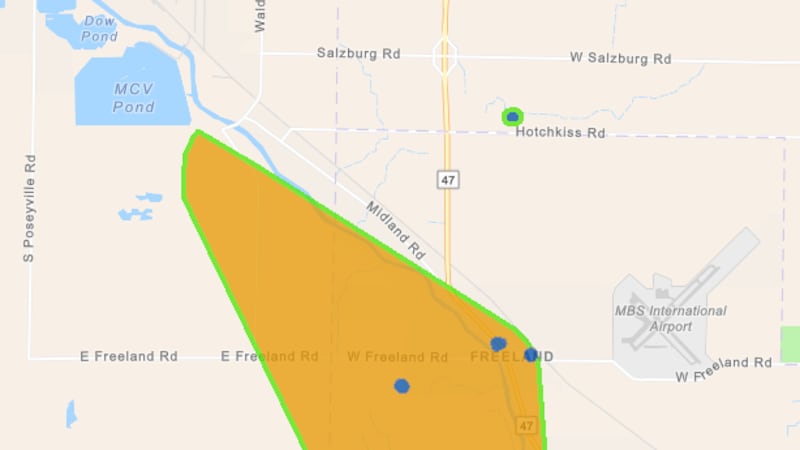
Several tornado warnings were issued earlier today, and we now have two confirmations of tornadoes. You can read specifics on those below:
As we work through the rest of the night, we don’t anticipate a repeat of earlier this afternoon, and we should be able to sleep well tonight. However, Wednesday and Thursday will bring more chances for severe storms.
For a complete look at your forecast, be sure to check out your TV5 First Alert 7-Day Forecast!
This Evening & Overnight
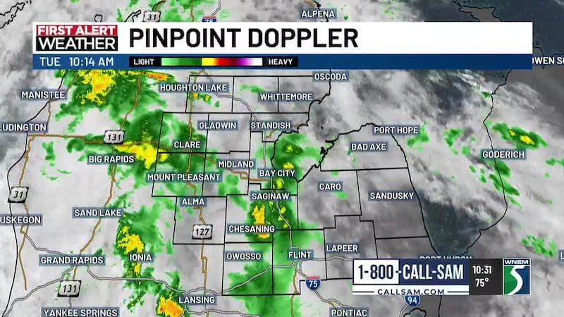
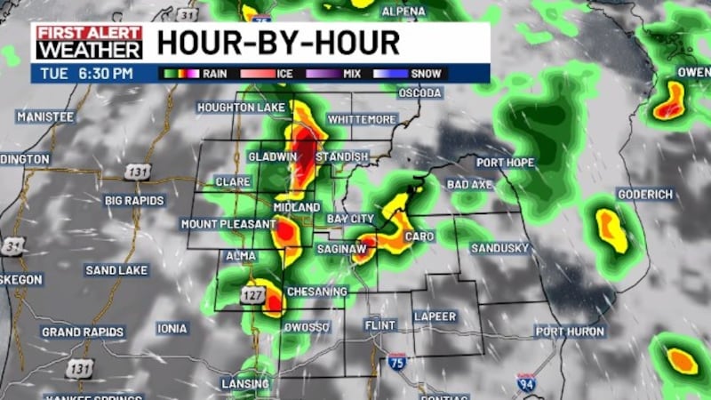
We expect rain and storms to remain possible for a bit tonight, but we do expect the late evening and overnight hours to be on the quieter side.
Before the rain ends this evening, we still expect a few showers and thunderstorms here and there. Although the threat for severe weather is generally pretty low. We’ll still keep our guard up to be safe, but if a storm does get strong, gusty winds would be more likely with microbursts, due to collapsing thunderstorms.
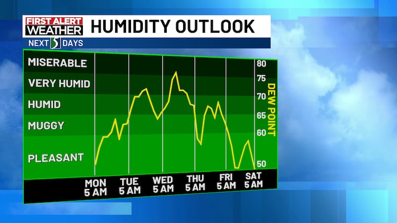
Overnight lows will remain very warm and muggy in the 60s to near 70, and with light westerly winds overnight and all the extra moisture, some areas may see fog tomorrow morning. Some of that fog could be locally dense.
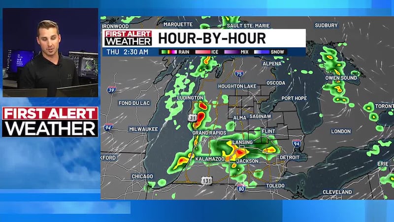
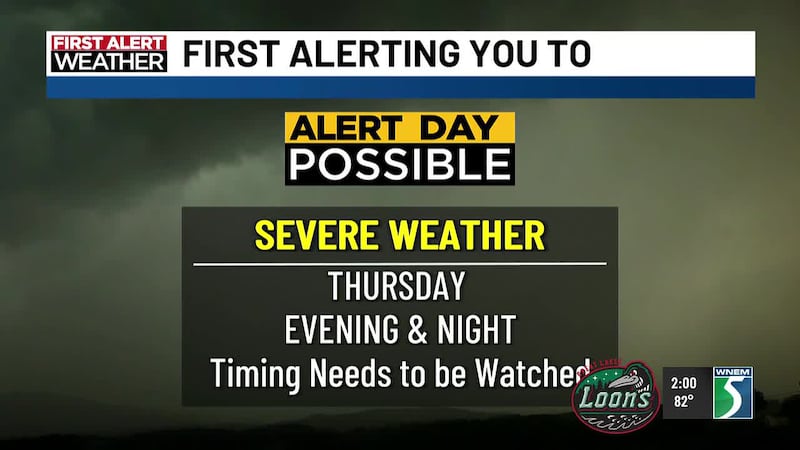
Wednesday & Thursday Storm Chances, Heat & Humidity
We expect Wednesday and Thursday to bring plenty of heat and humidity. It likely won’t be the worst heat we see this summer, but likely the first time we see heat index values come into play, with some reaching into the vicinity of 95°.
Those two conditions normally lead to thunderstorm development, but right now we do believe much of the daylight hours each day will be spent dry.
It’s possible we could see some scattered activity toward the late-afternoon and evening, but our primary concern both days (as currently projected on Tuesday night) is around the late evening and possibly overnight time frames.
We will have repeated rounds of thunderstorms developing to our west on Wednesday, and not all of them are expected to survive the trip into Mid-Michigan or even move toward our area. But these types of set ups are very tricky to pin down, so we’ll be watching their progress throughout the day.
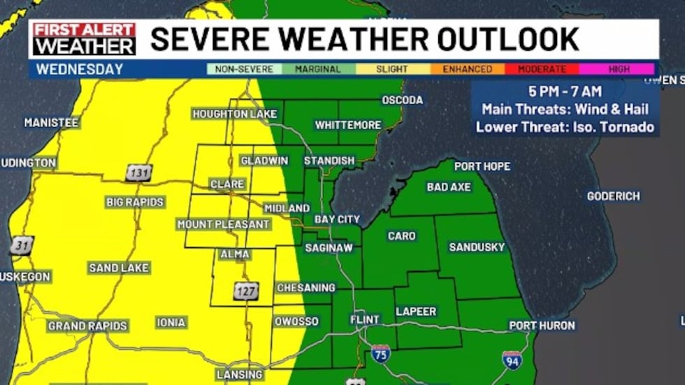
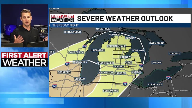
The environment over Mid-Michigan is not quite as good Wednesday compared to Thursday, which is why not all of thesr rounds may make it to us, but we still need to watch closely. We’re currently under a Marginal Risk for Wednesday for most of the area, with a Slight Risk up against the US-127 corridor. Damaging wind and hail are the main threats.
The window of concern may be refined on Wednesday, but right now a broad 5 PM Wednesday to potentially as far out as 7 AM Thursday could be needed.
Thursday should be fairly similar with thunderstorms remaining mostly to the west of us during the day with heat and humidity building through the day, but we’ll have a cold front coming through which should provide storms a bit more support on Thursday night when storms finally move in.
We are under a Slight Risk areawide, except for a small area near US-127 that is in the Enhanced Risk.
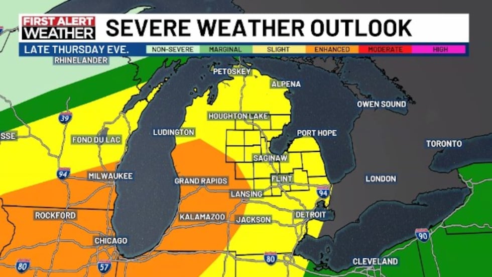
Damaging wind, hail, and tornadoes seem possible on Thursday. Wind would be the higher threat. Heavy rain and lightning of course also included.
It’s important to know that timing and exact storm paths are not set in stone, and are notoriously tricky in these set ups. It’s also very possible that how storms play out on Wednesday could very well have an effect on storm path and intensity on Thursday.
Stay tuned and stay with us for the next couple of days! This could be a day by day forecast.
Copyright 2026 WNEM. All rights reserved.