Unsettled weather returns on Tuesday, risk of strong storms
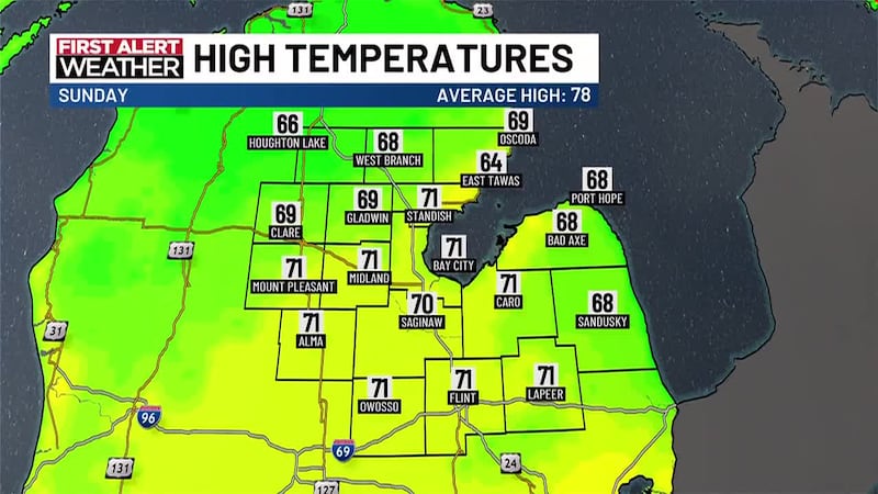
SAGINAW, Mich. (WNEM) - It’s been a beautiful transition back into the workweek, with plenty of sunshine and highs in the 70s.
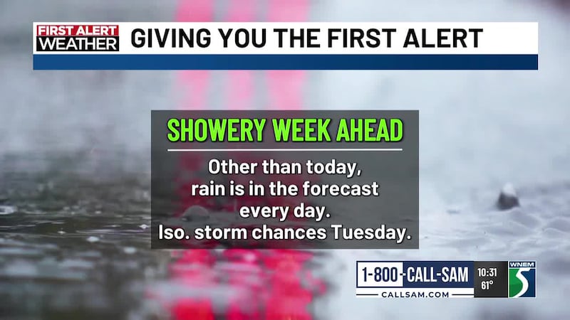
As we work through the next few days, rain chances will return which will be welcomed news for some, and probably not so great news for others. In addition to the rain, we’ll also be keeping tabs on a few chances for strong storms.
For a complete look at your forecast, be sure to check out your TV5 First Alert 7-Day Forecast!
This Evening & Overnight
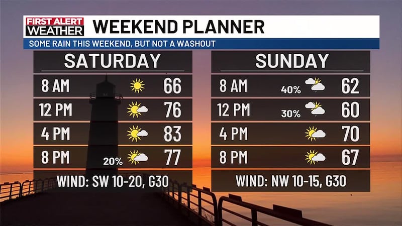
We should have a very pleasant evening ahead of us, even with the looming rain chances for tomorrow. Skies will be full of sunshine this evening and it looks like we’ll keep partly cloudy conditions going through much of the night.
Our sunset time tonight is around 9:18 PM.
Temperatures will drop off into the comfortable 50s for overnight lows, with a southwesterly wind around 5 to 10 miles per hour.
Tuesday
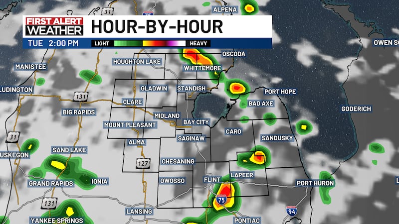
Clouds will be on the increase Tuesday as unsettled weather returns, but some pockets of sunshine will still be possible through the day, and could be important on where and how long they stick around for severe weather possibilities later in the day.
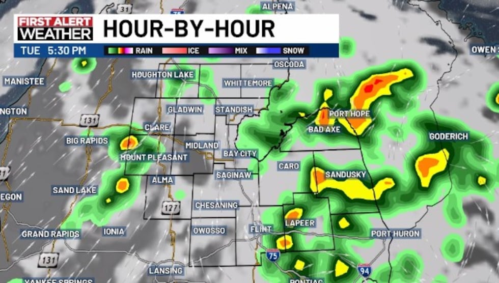
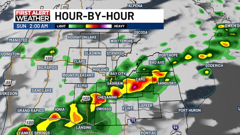
Most are expected to stay dry during the morning hours, though some isolated showers are possible early in the day. The afternoon and evening is likely where things will pick up, and may come in multiple waves.
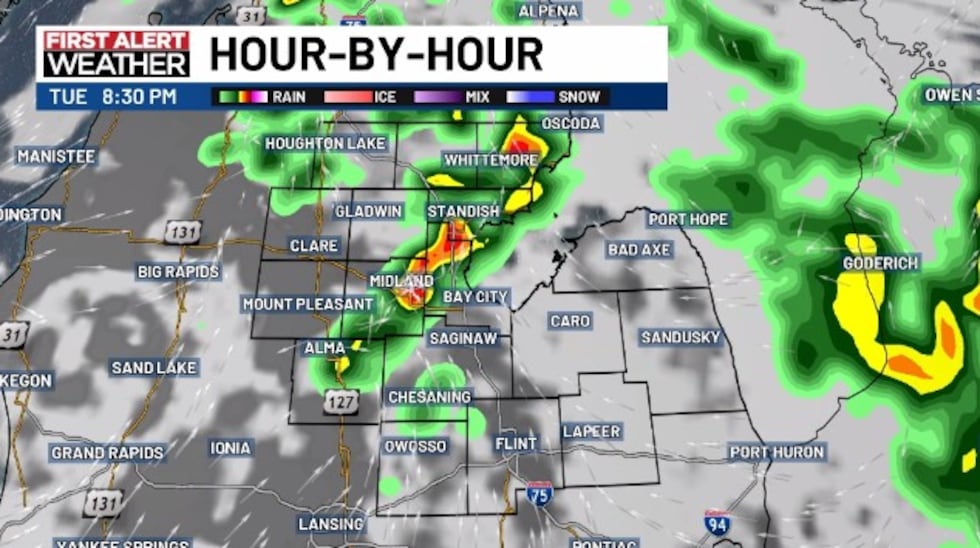
The initial wave is a little less likely to be severe than what develops later into the afternoon and evening, but we should be on guard from around 2 PM to 10 PM on Tuesday.
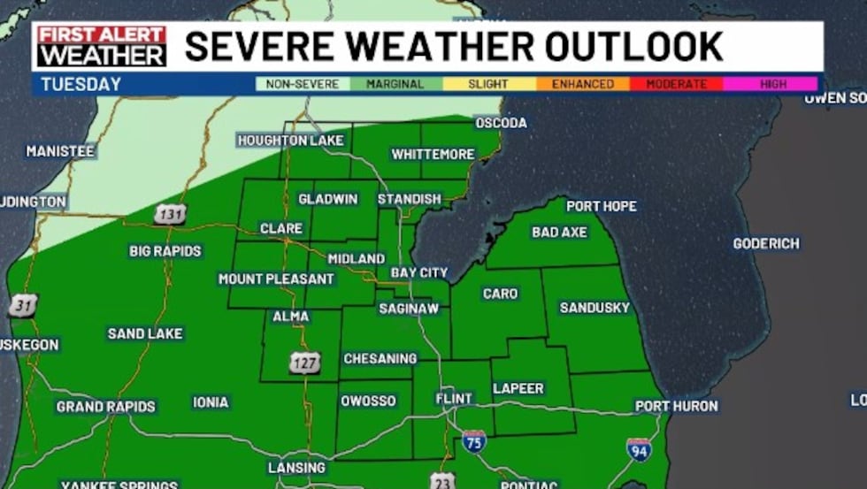
Just about all of the TV5 viewing area is under a Marginal Risk of severe weather, with wind, hail, and an isolated tornado all possible. A Marginal Risk typically suggests that most storms will not be severe, and the threat is more isolated. However, last week taught us that we should always pay attention.
Rainfall amounts will mostly be 0.50″ or less, but some locally heavy pockets over 1″ are possible.
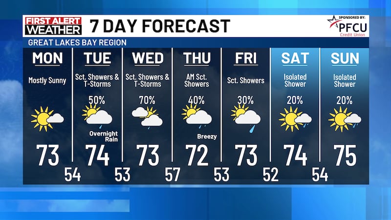
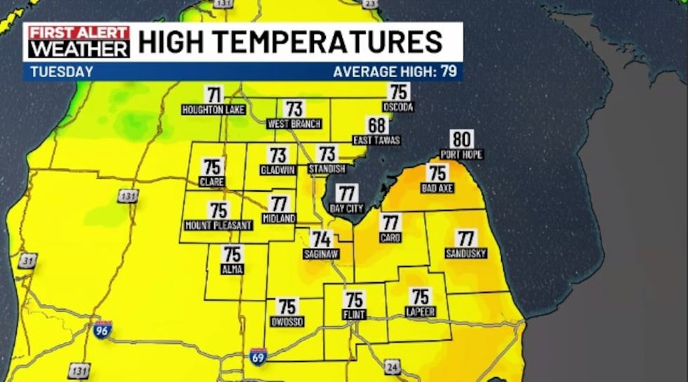
Highs will be around the lower to middle 70s on Tuesday, with a southwesterly wind around 10 to 20 miles per hour, gusting to 30 miles per hour.
Rain should taper off into the overnight hours, with temperatures dropping off into the upper 40s to middle 50s for overnight lows.
Wednesday
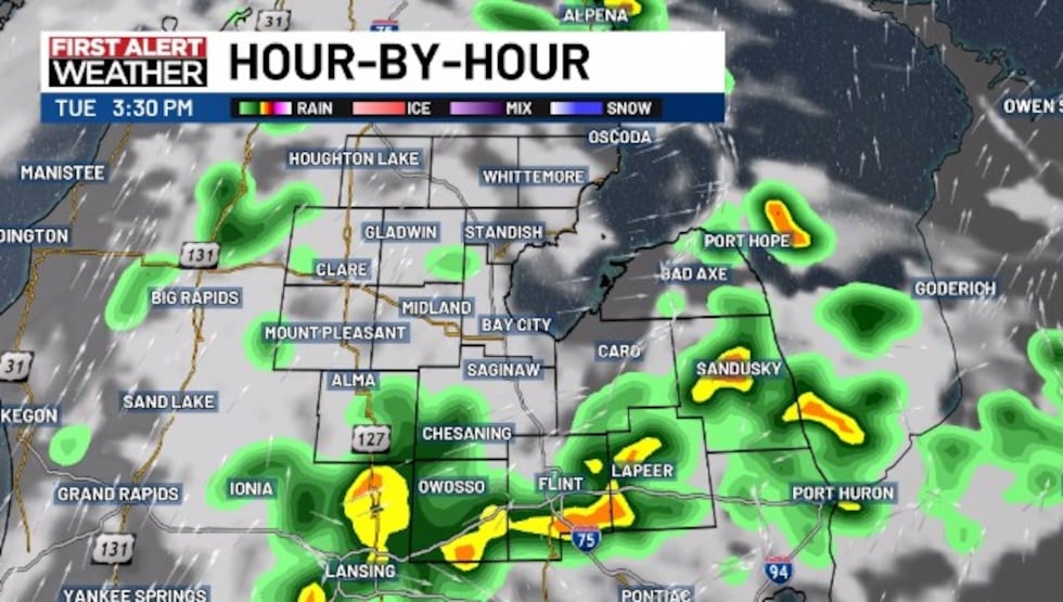
We may end up dry for a good chunk of Wednesday, with the better threat for rain closer to Wednesday evening and overnight into Thursday. This will be watched of course for anyone who has outdoor plans on Wednesday.
We’re also watching the potential for severe storms on Wednesday, and even in the absence of severe weather, there will be a risk for locally heavy rainfall. Again, this depends on location as there have been some areas that have gotten slammed, and others who have not received nearly as much.
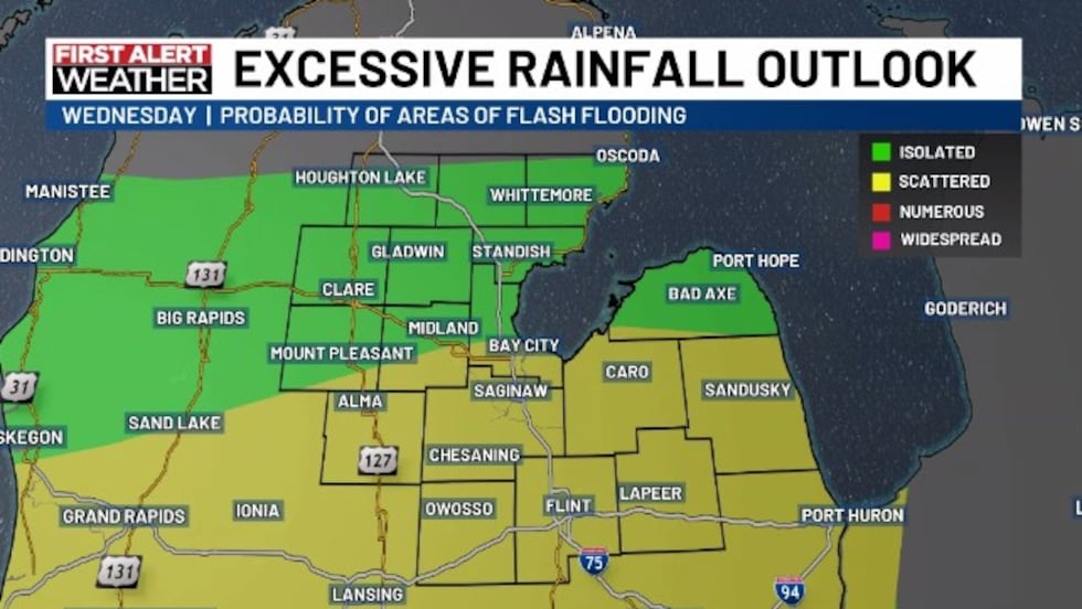
We are in the Excessive Rainfall Outlook (flooding risk) for the entire TV5 viewing area, with southern areas in the Slight Risk category. In the Slight Risk of this outlook, we expect multiple areas to have the possibility of flash-flooding, as opposed to more of an isolated risk in the Marginal areas.
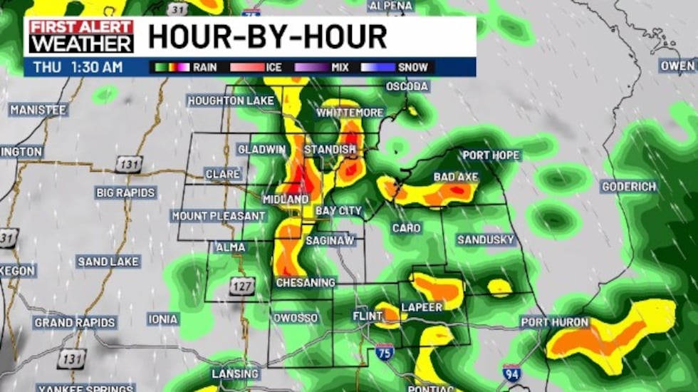
Despite storms remaining progressive, they may be efficient rainfall producers and some areas could pick up a quick 1-2″ or more of rain in a short period.
The severe weather threat right now seems to be greater to the south of the WNEM-TV5 viewing area, closer to I-94 and southward. However, part of our area is still under the Marginal Risk (Shiawassee & Genesee) and we’re still in the time period where things could shift north or south. If severe storms occur, all forms of severe weather are possible. We’ll monitor.
Highs will land in the upper 60s to middle 70s, with westerly to southwesterly winds through the day. Those winds will be near 5 to 15 miles per hour, with gusts near 20 to 25 miles per hour.
Rain will continue overnight into Thursday morning, so we’ll need to see if there is any severe threat overnight as we get into our better data tomorrow. There is a chance that not only could the best threat for severe storms be out of our area, but even south of the state.
Overnight lows into Thursday morning will dip into the lower to upper 50s.
Copyright 2026 WNEM. All rights reserved.